Mauritius
MUS
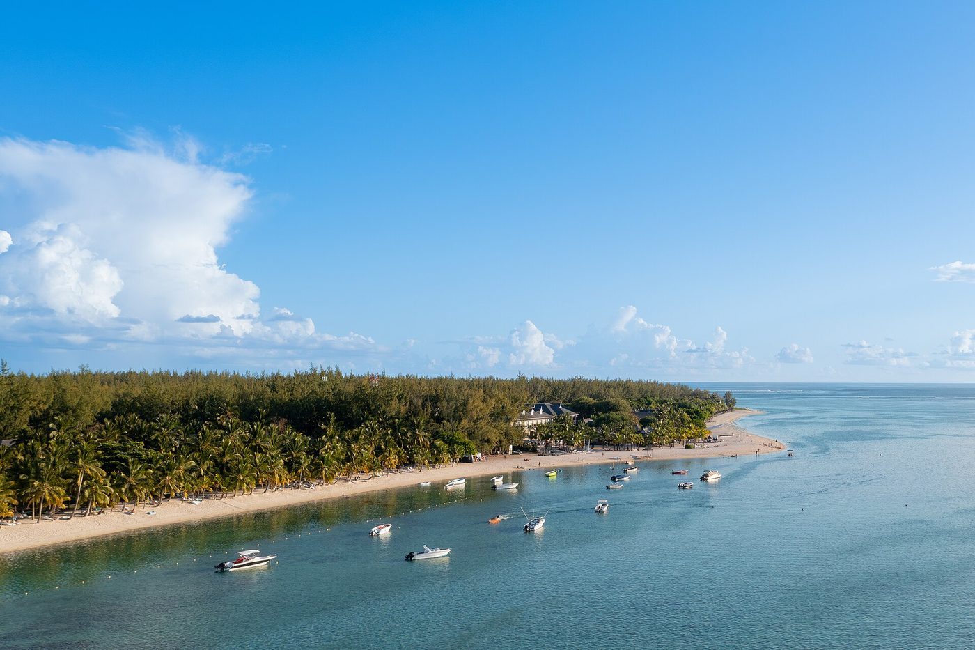
Aerial view of yachts at Le Morne Beach in Mauritius (53696879662) · Photo: "dronepicr" /
CC BY 2.0
via Wikimedia Commons

286
Records
10
Datasets
29
Tables
10
Sources
146
SEL Fields
39
CCL Fields
📋
Most recent national census: 2022.
HERA carries the
2018 round — the 2022 census is not yet
ingested (results may still be in staged release, or the source isn't published in a
machine-readable form yet). The figures below are 2018.
Loading overview…
Datasets (10)
SEL — DGIWG Statistical Extent Location
SEL+ — Platform extension (not in DGIWG core spec)
CCL — DGIWG Cultural Context Location
Extension — Preserved in extension tables (not in core SEL/CCL schema)
Pending — Not yet mapped to SEL/CCL. The field is still kept in the inventory and the download; nothing is dropped. Reference data that is not census (ports, risk indices) may stay here.
4 further sources (Afrobarometer, Ethnic Power Relations Dataset, GI-TOC / ENACT, Global Data Lab) are held but not offered: their licences do not permit commercial redistribution. HERA cites their published findings with attribution and can supply the data to organisations holding their own licence — ask us.
MUS World Bank Open Data
MUS-WORLD_BANK
Development Indicators
or use the per-admin-level buttons below. Free downloads return a 10-row sample.
Contact us for the full pack.
0
Admin 0
— 3 table(s)
MUS World Bank - Development Indicators
— 66 rows, 9 columns
Loading data…
Field details — 9 fields (type, nulls, unique, samples)
Standards-Aligned Fields (7)
| Field Name | Label | Type | Schema | Nulls | Unique | Samples |
|---|---|---|---|---|---|---|
country_code |
Country code | string | SEL | 0% | 1 | MU, MU, MU, MU, MU |
population_count |
Population count | float | SEL | 2% | 65 | 680331.0, 680757.0, 700349.0, 718861.0, 736381.0 |
life_expectancy |
Life expectancy | float | SEL | 3% | 62 | 58.4614146341463, 59.5666829268293, 60.4433902439024,... |
gdp_per_capita_usd |
Gdp per capita usd | float | SEL | 2% | 65 | 238.251033437494, 281.683081448637, 282.342386236302,... |
literacy_rate_pct |
Literacy rate percent | float | SEL | 85% | 10 | 79.870002746582, 84.3000030517578, 89.25,... |
under5_mortality_per_1000 |
Under5 mortality per 1000 | float | SEL | 3% | 50 | 102.0, 98.2, 93.1, 87.2, 84.0 |
poverty_headcount_pct |
Poverty headcount percent | float | SEL | 96% | 3 | 7.9, 10.4, 8.4 |
Extension Fields (2)
— supplemental data preserved outside core SEL/CCL schema
| Field Name | Label | Type | Nulls | Unique | Samples |
|---|---|---|---|---|---|
country_name |
country_name | string | 0% | 1 | Mauritius, Mauritius, Mauritius, Mauritius, Mauritius |
year |
year | integer | 0% | 66 | 1960, 1961, 1962, 1963, 1964 |
MUS World Bank - Health Indicators
— 66 rows, 14 columns
Loading data…
Field details — 14 fields (type, nulls, unique, samples)
Standards-Aligned Fields (12)
| Field Name | Label | Type | Schema | Nulls | Unique | Samples |
|---|---|---|---|---|---|---|
country_code |
Country code | string | SEL | 0% | 1 | MU, MU, MU, MU, MU |
life_expectancy |
Life expectancy | float | SEL | 3% | 62 | 58.4614146341463, 59.5666829268293, 60.4433902439024,... |
infant_mortality_per_1000 |
Infant mortality per 1000 | float | SEL | 17% | 43 | 30.0, 30.3, 30.2, 29.4, 28.1 |
under5_mortality_per_1000 |
Under5 mortality per 1000 | float | SEL | 3% | 50 | 102.0, 98.2, 93.1, 87.2, 84.0 |
maternal_mortality_per_100k |
Maternal mortality per 100k | float | SEL | 41% | 27 | 111.0, 106.0, 103.0, 93.0, 85.0 |
fertility_rate |
Fertility rate | float | SEL | 3% | 56 | 5.897, 5.982, 5.877, 6.18, 5.956 |
birth_rate_per_1000 |
Birth rate per 1000 | float | SEL | 3% | 56 | 39.407, 39.7, 38.8, 40.4, 38.9 |
death_rate_per_1000 |
Death rate per 1000 | float | SEL | 3% | 30 | 10.111, 9.8, 9.3, 9.7, 8.7 |
physicians_per_1000 |
Physicians per 1000 | float | SEL | 46% | 36 | 0.215, 0.255, 0.24, 0.235, 0.521 |
hospital_beds_per_1000 |
Hospital beds per 1000 | float | SEL | 50% | 29 | 4.71666669845581, 3.95160007476807, 3.29970002174377,... |
vaccination_rate_pct |
Vaccination rate percent | float | SEL | 32% | 16 | 89.0, 82.0, 94.0, 89.0, 85.0 |
health_expenditure_pct_gdp |
Health expenditure percent gdp | float | SEL | 64% | 24 | 2.85734653, 2.92151856, 3.18897271, 3.18201613, 3.31652546 |
Extension Fields (2)
— supplemental data preserved outside core SEL/CCL schema
| Field Name | Label | Type | Nulls | Unique | Samples |
|---|---|---|---|---|---|
country_name |
country_name | string | 0% | 1 | Mauritius, Mauritius, Mauritius, Mauritius, Mauritius |
year |
year | integer | 0% | 66 | 1960, 1961, 1962, 1963, 1964 |
MUS World Bank - Migration Indicators
— 66 rows, 9 columns
Loading data…
Field details — 9 fields (type, nulls, unique, samples)
Standards-Aligned Fields (1)
| Field Name | Label | Type | Schema | Nulls | Unique | Samples |
|---|---|---|---|---|---|---|
country_code |
country_code | string | SEL | 0% | 1 | MUS, MUS, MUS, MUS, MUS |
Pending (8) — awaiting mapping
| Field Name | Label | Type | Nulls | Unique | Samples |
|---|---|---|---|---|---|
country_name |
country_name | string | 0% | 1 | Mauritius, Mauritius, Mauritius, Mauritius, Mauritius |
year |
year | integer | 0% | 66 | 1960, 1961, 1962, 1963, 1964 |
intl_migrant_stock |
intl_migrant_stock | float | 88% | 8 | 3613.0, 7493.0, 15543.0, 19647.0, 24836.0 |
intl_migrant_stock_pct |
intl_migrant_stock_pct | float | 88% | 7 | 0.3, 0.6, 1.3, 1.6, 1.9 |
net_migration |
net_migration | float | 0% | 65 | -7083.0, -8984.0, -6107.0, -5236.0, -4850.0 |
remittances_received_usd |
remittances_received_usd | float | 53% | 31 | 118000000.0, 132000000.0, 160000000.0, 168000000.0, 180000000.0 |
remittances_received_pct_gdp |
remittances_received_pct_gdp | float | 53% | 31 | 3.27227773970301, 3.22364659870154, 3.57024133744505,... |
remittances_paid_usd |
remittances_paid_usd | float | 27% | 48 | 897998.5714, 908085.3462, 1622514.009, 1109682.918, 1561627.388 |
MUS UNHCR Refugee Data Finder
MUS-UNHCR
Migration
or use the per-admin-level buttons below. Free downloads return a 10-row sample.
Contact us for the full pack.
0
Admin 0
— 2 table(s)
MUS UNHCR - Hosted Populations
— 11 rows, 24 columns
Loading data…
Field details — 24 fields (type, nulls, unique, samples)
Standards-Aligned Fields (6)
| Field Name | Label | Type | Schema | Nulls | Unique | Samples |
|---|---|---|---|---|---|---|
country_of_origin_iso |
Country of origin iso | string | CCL | 0% | 1 | -, -, -, -, - |
refugees |
Refugees | integer | CCL | 0% | 75 | 2116011, 1952928, 1847304, 1749628, 1717966 |
idps |
Idps | integer | CCL | 0% | 34 | 0, 0, 0, 0, 0 |
stateless |
Stateless | integer | CCL | 0% | 23 | 0, 0, 0, 0, 0 |
others_of_concern |
Others of concern | integer | CCL | 0% | 30 | 0, 0, 0, 0, 0 |
total_population |
Total population | string | CCL | 100% | - | - |
Extension Fields (18)
— supplemental data preserved outside core SEL/CCL schema
| Field Name | Label | Type | Nulls | Unique | Samples |
|---|---|---|---|---|---|
year |
year | integer | 0% | 75 | 1951, 1952, 1953, 1954, 1955 |
country_of_origin |
country_of_origin | string | 100% | - | - |
country_of_asylum |
country_of_asylum | string | 100% | - | - |
country_of_asylum_iso |
country_of_asylum_iso | string | 0% | 1 | -, -, -, -, - |
population_type |
population_type | string | 100% | - | - |
asylum_seekers |
asylum_seekers | integer | 0% | 34 | 0, 0, 0, 0, 0 |
female_total |
female_total | string | 100% | - | - |
male_total |
male_total | string | 100% | - | - |
female_0_4 |
female_0_4 | string | 100% | - | - |
female_5_11 |
female_5_11 | string | 100% | - | - |
female_12_17 |
female_12_17 | string | 100% | - | - |
female_18_59 |
female_18_59 | string | 100% | - | - |
female_60_plus |
female_60_plus | string | 100% | - | - |
male_0_4 |
male_0_4 | string | 100% | - | - |
male_5_11 |
male_5_11 | string | 100% | - | - |
male_12_17 |
male_12_17 | string | 100% | - | - |
male_18_59 |
male_18_59 | string | 100% | - | - |
male_60_plus |
male_60_plus | string | 100% | - | - |
MUS UNHCR - Origin Populations
— 30 rows, 24 columns
Loading data…
Field details — 24 fields (type, nulls, unique, samples)
Standards-Aligned Fields (6)
| Field Name | Label | Type | Schema | Nulls | Unique | Samples |
|---|---|---|---|---|---|---|
country_of_origin_iso |
Country of origin iso | string | CCL | 0% | 1 | -, -, -, -, - |
refugees |
Refugees | integer | CCL | 0% | 75 | 2116011, 1952928, 1847304, 1749628, 1717966 |
idps |
Idps | integer | CCL | 0% | 34 | 0, 0, 0, 0, 0 |
stateless |
Stateless | integer | CCL | 0% | 23 | 0, 0, 0, 0, 0 |
others_of_concern |
Others of concern | integer | CCL | 0% | 30 | 0, 0, 0, 0, 0 |
total_population |
Total population | string | CCL | 100% | - | - |
Extension Fields (18)
— supplemental data preserved outside core SEL/CCL schema
| Field Name | Label | Type | Nulls | Unique | Samples |
|---|---|---|---|---|---|
year |
year | integer | 0% | 75 | 1951, 1952, 1953, 1954, 1955 |
country_of_origin |
country_of_origin | string | 100% | - | - |
country_of_asylum |
country_of_asylum | string | 100% | - | - |
country_of_asylum_iso |
country_of_asylum_iso | string | 0% | 1 | -, -, -, -, - |
population_type |
population_type | string | 100% | - | - |
asylum_seekers |
asylum_seekers | integer | 0% | 34 | 0, 0, 0, 0, 0 |
female_total |
female_total | string | 100% | - | - |
male_total |
male_total | string | 100% | - | - |
female_0_4 |
female_0_4 | string | 100% | - | - |
female_5_11 |
female_5_11 | string | 100% | - | - |
female_12_17 |
female_12_17 | string | 100% | - | - |
female_18_59 |
female_18_59 | string | 100% | - | - |
female_60_plus |
female_60_plus | string | 100% | - | - |
male_0_4 |
male_0_4 | string | 100% | - | - |
male_5_11 |
male_5_11 | string | 100% | - | - |
male_12_17 |
male_12_17 | string | 100% | - | - |
male_18_59 |
male_18_59 | string | 100% | - | - |
male_60_plus |
male_60_plus | string | 100% | - | - |
MUS LandScan Global (ORNL)
MUS-LANDSCAN
Modeled Population
or use the per-admin-level buttons below. Free downloads return a 10-row sample.
Contact us for the full pack.
0
Admin 0
— 1 table(s)
MUS LandScan - Population Admin0 (admin_0)
— 1 rows, 7 columns
Loading data…
Field details — 7 fields (type, nulls, unique, samples)
Standards-Aligned Fields (7)
| Field Name | Label | Type | Schema | Nulls | Unique | Samples |
|---|---|---|---|---|---|---|
country_code |
Country code | string | SEL | 0% | 1 | MUS |
admin_level |
Admin level | string | SEL | 0% | 1 | admin_0 |
admin_name |
Admin name | string | SEL | 0% | 1 | Mauritius |
admin_code |
Admin code | string | SEL | 0% | 1 | 6221475B96225440771281 |
area_sqkm |
Area sqkm | float | SEL | 0% | 1 | 1998.7163 |
pop_2024 |
Population count | integer | SEL | 0% | 1 | 1254147 |
pop_density_2024 |
Population density | float | SEL | 0% | 1 | 627.48 |
1
Admin 1
— 1 table(s)
MUS LandScan - Population Admin1 (admin_1)
— 12 rows, 7 columns
Loading data…
Field details — 7 fields (type, nulls, unique, samples)
Standards-Aligned Fields (7)
| Field Name | Label | Type | Schema | Nulls | Unique | Samples |
|---|---|---|---|---|---|---|
country_code |
Country code | string | SEL | 0% | 1 | MUS, MUS, MUS, MUS, MUS |
admin_level |
Admin level | string | SEL | 0% | 1 | admin_1, admin_1, admin_1, admin_1, admin_1 |
admin_name |
Admin name | string | SEL | 0% | 12 | Plaines Wilhems, Pamplemousses, Flacq, Rivière du... |
admin_code |
Admin code | string | SEL | 0% | 12 | 65221844B21568199301359, 65221844B91551715822340,... |
area_sqkm |
Area sqkm | float | SEL | 0% | 12 | 197.4579, 179.7817, 297.2464, 146.2792, 40.5798 |
pop_2024 |
Population count | integer | SEL | 0% | 12 | 384550, 149531, 133495, 108396, 101778 |
pop_density_2024 |
Population density | float | SEL | 0% | 12 | 1947.5, 831.74, 449.11, 741.02, 2508.1 |
Locality
Locality
— 1 table(s)
MUS LandScan - Cities (locality)
— 1 rows, 9 columns
Loading data…
Field details — 9 fields (type, nulls, unique, samples)
Standards-Aligned Fields (7)
| Field Name | Label | Type | Schema | Nulls | Unique | Samples |
|---|---|---|---|---|---|---|
country_code |
Country code | string | SEL | 0% | 1 | MUS |
admin_level |
Admin level | string | SEL | 0% | 1 | locality |
admin_name |
Admin name | string | SEL | 0% | 1 | Port Louis |
admin_code |
Admin code | integer | SEL | 0% | 1 | 159 |
area_sqkm |
Area sqkm | float | SEL | 0% | 1 | 135.3109 |
pop_2024 |
Population count | integer | SEL | 0% | 1 | 545369 |
pop_density_2024 |
Population density | float | SEL | 0% | 1 | 4030.49 |
Extension Fields (2)
— supplemental data preserved outside core SEL/CCL schema
| Field Name | Label | Type | Nulls | Unique | Samples |
|---|---|---|---|---|---|
ghs_pop_2025 |
ghs_pop_2025 | integer | 0% | 1 | 557431 |
landscan_vs_ghs_ratio |
landscan_vs_ghs_ratio | float | 0% | 1 | 0.978 |
MUS OpenFactBook
MUS-OPENFACTBOOK
Country Profile
or use the per-admin-level buttons below. Free downloads return a 10-row sample.
Contact us for the full pack.
0
Admin 0
— 14 table(s)
MUS OpenFactBook - Communications
— 1 rows, 21 columns
Loading data…
Field details — 22 fields (type, nulls, unique, samples)
Standards-Aligned Fields (7)
| Field Name | Label | Type | Schema | Nulls | Unique | Samples |
|---|---|---|---|---|---|---|
telephones_fixed_lines_subscriptions_per_100_inhabitants_numeric |
Fixed line subscriptions per 100 | float | SEL | 0% | 1 | 36.0 |
telephones_mobile_cellular_subscriptions_per_100_inhabitants_numeric |
Mobile subscriptions per 100 | float | SEL | 0% | 1 | 173.0 |
internet_users_percent_of_population_numeric |
Internet penetration percent | float | SEL | 0% | 1 | 80.0 |
broadband_fixed_subscriptions_subscriptions_per_100_inhabitants_numeric |
Broadband subscriptions per 100 | float | SEL | 0% | 1 | 27.0 |
country_code |
Country code | string | SEL | 0% | 1 | MUS |
country_name |
Country name | string | SEL | 0% | 1 | Mauritius |
admin_level |
Admin level | string | SEL | 0% | 1 | national |
Extension Fields (15)
— supplemental data preserved outside core SEL/CCL schema
| Field Name | Label | Type | Nulls | Unique | Samples |
|---|---|---|---|---|---|
telephones_fixed_lines_total_subscriptions_text |
telephones_fixed_lines_total_subscriptions_text | string | 0% | 1 | 464,000 (2023 est.) |
telephones_fixed_lines_total_subscriptions_numeric |
telephones_fixed_lines_total_subscriptions_numeric | float | 0% | 1 | 464000.0 |
telephones_fixed_lines_subscriptions_per_100_inhabitants_text |
telephones_fixed_lines_subscriptions_per_100_inhabitants_text | string | 0% | 1 | 36 (2023 est.) |
telephones_mobile_cellular_total_subscriptions_text |
telephones_mobile_cellular_total_subscriptions_text | string | 0% | 1 | 2.2 million (2024 est.) |
telephones_mobile_cellular_total_subscriptions_numeric |
telephones_mobile_cellular_total_subscriptions_numeric | float | 0% | 1 | 2.2 |
telephones_mobile_cellular_subscriptions_per_100_inhabitants_text |
telephones_mobile_cellular_subscriptions_per_100_inhabitants_text | string | 0% | 1 | 173 (2024 est.) |
broadcast_media_text |
broadcast_media_text | string | 0% | 1 | the Mauritius Broadcasting Corporation (MBC) is the... |
broadcast_media_numeric |
broadcast_media_numeric | float | 0% | 1 | 17.0 |
internet_country_code_text |
Internet country code text | string | 0% | 1 | .mu |
internet_users_percent_of_population_text |
internet_users_percent_of_population_text | string | 0% | 1 | 80% (2023 est.) |
broadband_fixed_subscriptions_total_text |
broadband_fixed_subscriptions_total_text | string | 0% | 1 | 343,000 (2023 est.) |
broadband_fixed_subscriptions_total_numeric |
broadband_fixed_subscriptions_total_numeric | float | 0% | 1 | 343000.0 |
broadband_fixed_subscriptions_subscriptions_per_100_inhabitants_text |
broadband_fixed_subscriptions_subscriptions_per_100_inhabitants_text | string | 0% | 1 | 27 (2023 est.) |
source_section |
source_section | string | 0% | 1 | Communications |
source_profile_path |
source_profile_path | string | 0% | 1 | africa/mp.json |
MUS OpenFactBook - Economy
— 1 rows, 149 columns
Loading data…
Field details — 155 fields (type, nulls, unique, samples)
Standards-Aligned Fields (6)
| Field Name | Label | Type | Schema | Nulls | Unique | Samples |
|---|---|---|---|---|---|---|
real_gdp_per_capita_real_gdp_per_capita_2024_numeric |
Real gdp per capita 2024 (numeric) | float | SEL | 0% | 1 | 27300.0 |
gdp_official_exchange_rate_numeric |
Gdp total usd | float | SEL | 0% | 1 | 14.953 |
population_below_poverty_line_numeric |
Poverty headcount percent | float | SEL | 0% | 1 | 10.3 |
country_code |
Country code | string | SEL | 0% | 1 | MUS |
country_name |
Country name | string | SEL | 0% | 1 | Mauritius |
admin_level |
Admin level | string | SEL | 0% | 1 | national |
Extension Fields (149)
— supplemental data preserved outside core SEL/CCL schema
| Field Name | Label | Type | Nulls | Unique | Samples |
|---|---|---|---|---|---|
economic_overview_text |
economic_overview_text | string | 0% | 1 | upper middle-income Indian Ocean island economy;... |
economic_overview_numeric |
economic_overview_numeric | float | 0% | 1 | -19.0 |
real_gdp_purchasing_power_parity_real_gdp_purchasing_power_parity_2024_text |
Real gdp purchasing power parity 2024 (text) | string | 0% | 1 | $34.406 billion (2024 est.) |
real_gdp_purchasing_power_parity_real_gdp_purchasing_power_parity_2024_numeric |
Real gdp purchasing power parity 2024 (numeric) | float | 0% | 1 | 34.406 |
real_gdp_purchasing_power_parity_real_gdp_purchasing_power_parity_2023_text |
Real gdp purchasing power parity 2023 (text) | string | 0% | 1 | $32.864 billion (2023 est.) |
real_gdp_purchasing_power_parity_real_gdp_purchasing_power_parity_2023_numeric |
Real gdp purchasing power parity 2023 (numeric) | float | 0% | 1 | 32.864 |
real_gdp_purchasing_power_parity_real_gdp_purchasing_power_parity_2022_text |
Real gdp purchasing power parity 2022 (text) | string | 0% | 1 | $31.296 billion (2022 est.) |
real_gdp_purchasing_power_parity_real_gdp_purchasing_power_parity_2022_numeric |
Real gdp purchasing power parity 2022 (numeric) | float | 0% | 1 | 31.296 |
real_gdp_purchasing_power_parity_note |
real_gdp_purchasing_power_parity_note | string | 0% | 1 | note: data in 2021 dollars |
real_gdp_growth_rate_real_gdp_growth_rate_2024_text |
Real gdp growth rate 2024 (text) | string | 0% | 1 | 4.7% (2024 est.) |
real_gdp_growth_rate_real_gdp_growth_rate_2024_numeric |
Real gdp growth rate 2024 (numeric) | float | 0% | 1 | 4.7 |
real_gdp_growth_rate_real_gdp_growth_rate_2023_text |
Real gdp growth rate 2023 (text) | string | 0% | 1 | 5% (2023 est.) |
real_gdp_growth_rate_real_gdp_growth_rate_2023_numeric |
Real gdp growth rate 2023 (numeric) | float | 0% | 1 | 5.0 |
real_gdp_growth_rate_real_gdp_growth_rate_2022_text |
Real gdp growth rate 2022 (text) | string | 0% | 1 | 8.7% (2022 est.) |
real_gdp_growth_rate_real_gdp_growth_rate_2022_numeric |
Real gdp growth rate 2022 (numeric) | float | 0% | 1 | 8.7 |
real_gdp_growth_rate_note |
real_gdp_growth_rate_note | string | 0% | 1 | note: annual GDP % growth based on constant local currency |
real_gdp_per_capita_real_gdp_per_capita_2024_text |
Real gdp per capita 2024 (text) | string | 0% | 1 | $27,300 (2024 est.) |
real_gdp_per_capita_real_gdp_per_capita_2023_text |
Real gdp per capita 2023 (text) | string | 0% | 1 | $26,100 (2023 est.) |
real_gdp_per_capita_real_gdp_per_capita_2023_numeric |
Real gdp per capita 2023 (numeric) | float | 0% | 1 | 26100.0 |
real_gdp_per_capita_real_gdp_per_capita_2022_text |
Real gdp per capita 2022 (text) | string | 0% | 1 | $24,800 (2022 est.) |
real_gdp_per_capita_real_gdp_per_capita_2022_numeric |
Real gdp per capita 2022 (numeric) | float | 0% | 1 | 24800.0 |
real_gdp_per_capita_note |
real_gdp_per_capita_note | string | 0% | 1 | note: data in 2021 dollars |
gdp_official_exchange_rate_text |
gdp_official_exchange_rate_text | string | 0% | 1 | $14.953 billion (2024 est.) |
inflation_rate_consumer_prices_inflation_rate_consumer_prices_2024_text |
Inflation rate consumer prices 2024 (text) | string | 0% | 1 | 3.6% (2024 est.) |
inflation_rate_consumer_prices_inflation_rate_consumer_prices_2024_numeric |
Inflation rate consumer prices 2024 (numeric) | float | 0% | 1 | 3.6 |
inflation_rate_consumer_prices_inflation_rate_consumer_prices_2023_text |
Inflation rate consumer prices 2023 (text) | string | 0% | 1 | 7.1% (2023 est.) |
inflation_rate_consumer_prices_inflation_rate_consumer_prices_2023_numeric |
Inflation rate consumer prices 2023 (numeric) | float | 0% | 1 | 7.1 |
inflation_rate_consumer_prices_inflation_rate_consumer_prices_2022_text |
Inflation rate consumer prices 2022 (text) | string | 0% | 1 | 10.8% (2022 est.) |
inflation_rate_consumer_prices_inflation_rate_consumer_prices_2022_numeric |
Inflation rate consumer prices 2022 (numeric) | float | 0% | 1 | 10.8 |
inflation_rate_consumer_prices_note |
inflation_rate_consumer_prices_note | string | 0% | 1 | note: annual % change based on consumer prices |
| +119 more extension fields — download the CSV/Parquet to see them all. | |||||
MUS OpenFactBook - Energy
— 1 rows, 35 columns
Loading data…
Field details — 35 fields (type, nulls, unique, samples)
Standards-Aligned Fields (4)
| Field Name | Label | Type | Schema | Nulls | Unique | Samples |
|---|---|---|---|---|---|---|
electricity_access_electrification_total_population_numeric |
Electricity access percent | float | SEL | 0% | 1 | 100.0 |
country_code |
Country code | string | SEL | 0% | 1 | MUS |
country_name |
Country name | string | SEL | 0% | 1 | Mauritius |
admin_level |
Admin level | string | SEL | 0% | 1 | national |
Extension Fields (31)
— supplemental data preserved outside core SEL/CCL schema
| Field Name | Label | Type | Nulls | Unique | Samples |
|---|---|---|---|---|---|
electricity_access_electrification_total_population_text |
electricity_access_electrification_total_population_text | string | 0% | 1 | 100% (2022 est.) |
electricity_access_electrification_urban_areas_text |
electricity_access_electrification_urban_areas_text | string | 0% | 1 | 99% |
electricity_access_electrification_urban_areas_numeric |
electricity_access_electrification_urban_areas_numeric | float | 0% | 1 | 99.0 |
electricity_access_electrification_rural_areas_text |
electricity_access_electrification_rural_areas_text | string | 0% | 1 | 100% |
electricity_access_electrification_rural_areas_numeric |
electricity_access_electrification_rural_areas_numeric | float | 0% | 1 | 100.0 |
electricity_installed_generating_capacity_text |
electricity_installed_generating_capacity_text | string | 0% | 1 | 955,000 kW (2023 est.) |
electricity_installed_generating_capacity_numeric |
electricity_installed_generating_capacity_numeric | float | 0% | 1 | 955000.0 |
electricity_consumption_text |
electricity_consumption_text | string | 0% | 1 | 3.084 billion kWh (2023 est.) |
electricity_consumption_numeric |
electricity_consumption_numeric | float | 0% | 1 | 3.084 |
electricity_transmission_distribution_losses_text |
electricity_transmission_distribution_losses_text | string | 0% | 1 | 179.996 million kWh (2023 est.) |
electricity_transmission_distribution_losses_numeric |
electricity_transmission_distribution_losses_numeric | float | 0% | 1 | 179.996 |
electricity_generation_sources_fossil_fuels_text |
electricity_generation_sources_fossil_fuels_text | string | 0% | 1 | 82.4% of total installed capacity (2023 est.) |
electricity_generation_sources_fossil_fuels_numeric |
electricity_generation_sources_fossil_fuels_numeric | float | 0% | 1 | 82.4 |
electricity_generation_sources_solar_text |
electricity_generation_sources_solar_text | string | 0% | 1 | 4.6% of total installed capacity (2023 est.) |
electricity_generation_sources_solar_numeric |
electricity_generation_sources_solar_numeric | float | 0% | 1 | 4.6 |
electricity_generation_sources_wind_text |
electricity_generation_sources_wind_text | string | 0% | 1 | 0.3% of total installed capacity (2023 est.) |
electricity_generation_sources_wind_numeric |
electricity_generation_sources_wind_numeric | float | 0% | 1 | 0.3 |
electricity_generation_sources_hydroelectricity_text |
electricity_generation_sources_hydroelectricity_text | string | 0% | 1 | 2.9% of total installed capacity (2023 est.) |
electricity_generation_sources_hydroelectricity_numeric |
electricity_generation_sources_hydroelectricity_numeric | float | 0% | 1 | 2.9 |
electricity_generation_sources_biomass_and_waste_text |
electricity_generation_sources_biomass_and_waste_text | string | 0% | 1 | 9.9% of total installed capacity (2023 est.) |
electricity_generation_sources_biomass_and_waste_numeric |
electricity_generation_sources_biomass_and_waste_numeric | float | 0% | 1 | 9.9 |
coal_consumption_text |
coal_consumption_text | string | 0% | 1 | 651,000 metric tons (2023 est.) |
coal_consumption_numeric |
coal_consumption_numeric | float | 0% | 1 | 651000.0 |
coal_imports_text |
coal_imports_text | string | 0% | 1 | 610,000 metric tons (2023 est.) |
coal_imports_numeric |
coal_imports_numeric | float | 0% | 1 | 610000.0 |
petroleum_refined_petroleum_consumption_text |
petroleum_refined_petroleum_consumption_text | string | 0% | 1 | 28,000 bbl/day (2023 est.) |
petroleum_refined_petroleum_consumption_numeric |
petroleum_refined_petroleum_consumption_numeric | float | 0% | 1 | 28000.0 |
energy_consumption_per_capita_total_energy_consumption_per_capita_2023_text |
energy_consumption_per_capita_total_energy_consumption_per_capita_2023_text | string | 0% | 1 | 60.188 million Btu/person (2023 est.) |
energy_consumption_per_capita_total_energy_consumption_per_capita_2023_numeric |
energy_consumption_per_capita_total_energy_consumption_per_capita_2023_numeric | float | 0% | 1 | 60.188 |
source_section |
source_section | string | 0% | 1 | Energy |
| +1 more extension field — download the CSV/Parquet to see them all. | |||||
MUS OpenFactBook - Environment
— 1 rows, 42 columns
Loading data…
Field details — 45 fields (type, nulls, unique, samples)
Standards-Aligned Fields (8)
| Field Name | Label | Type | Schema | Nulls | Unique | Samples |
|---|---|---|---|---|---|---|
land_use_agricultural_land_numeric |
Agricultural land percent | float | SEL | 0% | 1 | 43.0 |
land_use_forest_numeric |
Forest area percent | float | SEL | 0% | 1 | 19.2 |
urbanization_urban_population_numeric |
Urban population percent | float | SEL | 0% | 1 | 40.9 |
urbanization_rate_of_urbanization_numeric |
Urban growth rate percent | float | SEL | 0% | 1 | 0.28 |
waste_and_recycling_municipal_solid_waste_generated_annually_numeric |
Municipal waste kg per capita | float | SEL | 0% | 1 | 438000.0 |
country_code |
Country code | string | SEL | 0% | 1 | MUS |
country_name |
Country name | string | SEL | 0% | 1 | Mauritius |
admin_level |
Admin level | string | SEL | 0% | 1 | national |
Extension Fields (37)
— supplemental data preserved outside core SEL/CCL schema
| Field Name | Label | Type | Nulls | Unique | Samples |
|---|---|---|---|---|---|
environmental_issues_text |
environmental_issues_text | string | 0% | 1 | water pollution, degradation of coral reefs; soil... |
international_environmental_agreements_party_to_text |
international_environmental_agreements_party_to_text | string | 0% | 1 | Antarctic-Marine Living Resources, Biodiversity, Climate... |
international_environmental_agreements_signed_but_not_ratified_text |
international_environmental_agreements_signed_but_not_ratified_text | string | 0% | 1 | none of the selected agreements |
climate_text |
climate_text | string | 0% | 1 | tropical, modified by southeast trade winds; warm, dry... |
land_use_agricultural_land_text |
land_use_agricultural_land_text | string | 0% | 1 | 43% (2023 est.) |
land_use_agricultural_land_arable_land_text |
land_use_agricultural_land_arable_land_text | string | 0% | 1 | arable land: 37.6% (2023 est.) |
land_use_agricultural_land_arable_land_numeric |
land_use_agricultural_land_arable_land_numeric | float | 0% | 1 | 37.6 |
land_use_agricultural_land_permanent_crops_text |
land_use_agricultural_land_permanent_crops_text | string | 0% | 1 | permanent crops: 2% (2023 est.) |
land_use_agricultural_land_permanent_crops_numeric |
land_use_agricultural_land_permanent_crops_numeric | float | 0% | 1 | 2.0 |
land_use_agricultural_land_permanent_pasture_text |
land_use_agricultural_land_permanent_pasture_text | string | 0% | 1 | permanent pasture: 3.5% (2023 est.) |
land_use_agricultural_land_permanent_pasture_numeric |
land_use_agricultural_land_permanent_pasture_numeric | float | 0% | 1 | 3.5 |
land_use_forest_text |
land_use_forest_text | string | 0% | 1 | 19.2% (2023 est.) |
land_use_other_text |
land_use_other_text | string | 0% | 1 | 37.8% (2023 est.) |
land_use_other_numeric |
land_use_other_numeric | float | 0% | 1 | 37.8 |
urbanization_urban_population_text |
urbanization_urban_population_text | string | 0% | 1 | 40.9% of total population (2023) |
urbanization_rate_of_urbanization_text |
urbanization_rate_of_urbanization_text | string | 0% | 1 | 0.28% annual rate of change (2020-25 est.) |
carbon_dioxide_emissions_total_emissions_text |
carbon_dioxide_emissions_total_emissions_text | string | 0% | 1 | 5.551 million metric tonnes of CO2 (2023 est.) |
carbon_dioxide_emissions_total_emissions_numeric |
carbon_dioxide_emissions_total_emissions_numeric | float | 0% | 1 | 5.551 |
carbon_dioxide_emissions_from_coal_and_metallurgical_coke_text |
carbon_dioxide_emissions_from_coal_and_metallurgical_coke_text | string | 0% | 1 | 1.495 million metric tonnes of CO2 (2023 est.) |
carbon_dioxide_emissions_from_coal_and_metallurgical_coke_numeric |
carbon_dioxide_emissions_from_coal_and_metallurgical_coke_numeric | float | 0% | 1 | 1.495 |
carbon_dioxide_emissions_from_petroleum_and_other_liquids_text |
carbon_dioxide_emissions_from_petroleum_and_other_liquids_text | string | 0% | 1 | 4.056 million metric tonnes of CO2 (2023 est.) |
carbon_dioxide_emissions_from_petroleum_and_other_liquids_numeric |
carbon_dioxide_emissions_from_petroleum_and_other_liquids_numeric | float | 0% | 1 | 4.056 |
particulate_matter_emissions_text |
particulate_matter_emissions_text | string | 0% | 1 | 10.5 micrograms per cubic meter (2019 est.) |
particulate_matter_emissions_numeric |
particulate_matter_emissions_numeric | float | 0% | 1 | 10.5 |
waste_and_recycling_municipal_solid_waste_generated_annually_text |
waste_and_recycling_municipal_solid_waste_generated_annually_text | string | 0% | 1 | 438,000 tons (2024 est.) |
waste_and_recycling_percent_of_municipal_solid_waste_recycled_text |
waste_and_recycling_percent_of_municipal_solid_waste_recycled_text | string | 0% | 1 | 15.9% (2022 est.) |
waste_and_recycling_percent_of_municipal_solid_waste_recycled_numeric |
waste_and_recycling_percent_of_municipal_solid_waste_recycled_numeric | float | 0% | 1 | 15.9 |
total_water_withdrawal_municipal_text |
total_water_withdrawal_municipal_text | string | 0% | 1 | 320 million cubic meters (2022) |
total_water_withdrawal_municipal_numeric |
total_water_withdrawal_municipal_numeric | float | 0% | 1 | 320.0 |
total_water_withdrawal_industrial_text |
total_water_withdrawal_industrial_text | string | 0% | 1 | 10 million cubic meters (2022) |
| +7 more extension fields — download the CSV/Parquet to see them all. | |||||
MUS OpenFactBook - Ethnic Groups
— 1 rows, 8 columns
Loading data…
Field details — 8 fields (type, nulls, unique, samples)
Standards-Aligned Fields (3)
| Field Name | Label | Type | Schema | Nulls | Unique | Samples |
|---|---|---|---|---|---|---|
country_code |
Country code | string | SEL | 0% | 1 | MUS |
country_name |
Country name | string | SEL | 0% | 1 | Mauritius |
admin_level |
Admin level | string | SEL | 0% | 1 | national |
Extension Fields (5)
— supplemental data preserved outside core SEL/CCL schema
| Field Name | Label | Type | Nulls | Unique | Samples |
|---|---|---|---|---|---|
nationality_noun_text |
nationality_noun_text | string | 0% | 1 | Mauritian(s) |
nationality_adjective_text |
nationality_adjective_text | string | 0% | 1 | Mauritian |
ethnic_groups_text |
ethnic_groups_text | string | 0% | 1 | Indo-Mauritian (compose approximately two thirds of the... |
source_section |
source_section | string | 0% | 1 | People and Society:ethnic_groups |
source_profile_path |
source_profile_path | string | 0% | 1 | africa/mp.json |
MUS OpenFactBook - Geography
— 1 rows, 52 columns
Loading data…
Field details — 54 fields (type, nulls, unique, samples)
Standards-Aligned Fields (13)
| Field Name | Label | Type | Schema | Nulls | Unique | Samples |
|---|---|---|---|---|---|---|
area_total_numeric |
Area sqkm | float | SEL | 0% | 1 | 2040.0 |
area_land_numeric |
Area land sqkm | float | SEL | 0% | 1 | 2030.0 |
area_water_numeric |
Area water sqkm | float | SEL | 0% | 1 | 10.0 |
land_boundaries_total_numeric |
Land boundary km | float | SEL | 0% | 1 | 0.0 |
coastline_numeric |
Coastline km | float | SEL | 0% | 1 | 177.0 |
elevation_highest_point_numeric |
Elevation max m | float | SEL | 0% | 1 | 828.0 |
elevation_lowest_point_numeric |
Elevation min m | float | SEL | 0% | 1 | 0.0 |
land_use_agricultural_land_numeric |
Agricultural land percent | float | SEL | 0% | 1 | 43.0 |
land_use_forest_numeric |
Forest area percent | float | SEL | 0% | 1 | 19.2 |
irrigated_land_numeric |
Irrigated land sqkm | float | SEL | 0% | 1 | 143.0 |
country_code |
Country code | string | SEL | 0% | 1 | MUS |
country_name |
Country name | string | SEL | 0% | 1 | Mauritius |
admin_level |
Admin level | string | SEL | 0% | 1 | national |
Extension Fields (41)
— supplemental data preserved outside core SEL/CCL schema
| Field Name | Label | Type | Nulls | Unique | Samples |
|---|---|---|---|---|---|
location_text |
location_text | string | 0% | 1 | Southern Africa, island in the Indian Ocean, about 800... |
location_numeric |
location_numeric | float | 0% | 1 | 800.0 |
geographic_coordinates_text |
geographic_coordinates_text | string | 0% | 1 | 20 17 S, 57 33 E |
geographic_coordinates_numeric |
geographic_coordinates_numeric | float | 0% | 1 | 20.0 |
map_references_text |
map_references_text | string | 0% | 1 | Africa |
area_total_text |
area_total_text | string | 0% | 1 | 2,040 sq km |
area_land_text |
area_land_text | string | 0% | 1 | 2,030 sq km |
area_water_text |
area_water_text | string | 0% | 1 | 10 sq km |
area_note |
area_note | string | 0% | 1 | note: includes Agalega Islands, Cargados Carajos Shoals... |
area_comparative_text |
area_comparative_text | string | 0% | 1 | almost 11 times the size of Washington, D.C. |
area_comparative_numeric |
area_comparative_numeric | float | 0% | 1 | 11.0 |
land_boundaries_total_text |
land_boundaries_total_text | string | 0% | 1 | 0 km |
coastline_text |
coastline_text | string | 0% | 1 | 177 km |
maritime_claims_territorial_sea_text |
maritime_claims_territorial_sea_text | string | 0% | 1 | 12 nm |
maritime_claims_territorial_sea_numeric |
maritime_claims_territorial_sea_numeric | float | 0% | 1 | 12.0 |
maritime_claims_exclusive_economic_zone_text |
maritime_claims_exclusive_economic_zone_text | string | 0% | 1 | 200 nm |
maritime_claims_exclusive_economic_zone_numeric |
maritime_claims_exclusive_economic_zone_numeric | float | 0% | 1 | 200.0 |
maritime_claims_continental_shelf_text |
maritime_claims_continental_shelf_text | string | 0% | 1 | 200 nm or to the edge of the continental margin |
maritime_claims_continental_shelf_numeric |
maritime_claims_continental_shelf_numeric | float | 0% | 1 | 200.0 |
maritime_claims_note |
maritime_claims_note | string | 0% | 1 | note: measured from claimed archipelagic straight baselines |
climate_text |
climate_text | string | 0% | 1 | tropical, modified by southeast trade winds; warm, dry... |
terrain_text |
terrain_text | string | 0% | 1 | small coastal plain rising to discontinuous mountains... |
elevation_highest_point_text |
elevation_highest_point_text | string | 0% | 1 | Mont Piton 828 m |
elevation_lowest_point_text |
elevation_lowest_point_text | string | 0% | 1 | Indian Ocean 0 m |
natural_resources_text |
natural_resources_text | string | 0% | 1 | arable land, fish |
land_use_agricultural_land_text |
land_use_agricultural_land_text | string | 0% | 1 | 43% (2023 est.) |
land_use_agricultural_land_arable_land_text |
land_use_agricultural_land_arable_land_text | string | 0% | 1 | arable land: 37.6% (2023 est.) |
land_use_agricultural_land_arable_land_numeric |
land_use_agricultural_land_arable_land_numeric | float | 0% | 1 | 37.6 |
land_use_agricultural_land_permanent_crops_text |
land_use_agricultural_land_permanent_crops_text | string | 0% | 1 | permanent crops: 2% (2023 est.) |
land_use_agricultural_land_permanent_crops_numeric |
land_use_agricultural_land_permanent_crops_numeric | float | 0% | 1 | 2.0 |
| +11 more extension fields — download the CSV/Parquet to see them all. | |||||
MUS OpenFactBook - Government
— 1 rows, 80 columns
Loading data…
Field details — 107 fields (type, nulls, unique, samples)
Standards-Aligned Fields (2)
| Field Name | Label | Type | Schema | Nulls | Unique | Samples |
|---|---|---|---|---|---|---|
country_code |
Country code | string | SEL | 0% | 1 | MUS |
admin_level |
Admin level | string | SEL | 0% | 1 | national |
Extension Fields (105)
— supplemental data preserved outside core SEL/CCL schema
| Field Name | Label | Type | Nulls | Unique | Samples |
|---|---|---|---|---|---|
country_name_conventional_long_form_text |
country_name_conventional_long_form_text | string | 0% | 1 | Republic of Mauritius |
country_name_conventional_short_form_text |
country_name_conventional_short_form_text | string | 0% | 1 | Mauritius |
country_name_local_long_form_text |
country_name_local_long_form_text | string | 0% | 1 | Republic of Mauritius |
country_name_local_short_form_text |
country_name_local_short_form_text | string | 0% | 1 | Mauritius |
country_name_etymology_text |
country_name_etymology_text | string | 0% | 1 | named after Prince Maurice VAN NASSAU, stadtholder... |
country_name_etymology_numeric |
country_name_etymology_numeric | float | 0% | 1 | 1598.0 |
country_name_note |
country_name_note | string | 0% | 1 | note: pronounced mahr-ish-us |
government_type_text |
government_type_text | string | 0% | 1 | parliamentary republic |
capital_name_text |
capital_name_text | string | 0% | 1 | Port Louis |
capital_geographic_coordinates_text |
capital_geographic_coordinates_text | string | 0% | 1 | 20 09 S, 57 29 E |
capital_geographic_coordinates_numeric |
capital_geographic_coordinates_numeric | float | 0% | 1 | 20.0 |
capital_time_difference_text |
capital_time_difference_text | string | 0% | 1 | UTC+4 (9 hours ahead of Washington, DC, during Standard Time) |
capital_time_difference_numeric |
capital_time_difference_numeric | float | 0% | 1 | 4.0 |
capital_etymology_text |
capital_etymology_text | string | 0% | 1 | named after LOUIS XV, who was king of France in 1736... |
capital_etymology_numeric |
capital_etymology_numeric | float | 0% | 1 | 1736.0 |
administrative_divisions_text |
administrative_divisions_text | string | 0% | 1 | 9 districts and 3 dependencies*; Agalega Islands*, Black... |
administrative_divisions_numeric |
administrative_divisions_numeric | float | 0% | 1 | 9.0 |
legal_system_text |
legal_system_text | string | 0% | 1 | civil system based on French civil law with some... |
constitution_history_text |
constitution_history_text | string | 0% | 1 | several previous; latest adopted 12 March 1968 |
constitution_history_numeric |
constitution_history_numeric | float | 0% | 1 | 12.0 |
constitution_amendment_process_text |
constitution_amendment_process_text | string | 0% | 1 | proposed by the National Assembly; passage of amendments... |
international_law_organization_participation_text |
international_law_organization_participation_text | string | 0% | 1 | accepts compulsory ICJ jurisdiction with reservations;... |
citizenship_citizenship_by_birth_text |
Citizenship by birth (text) | string | 0% | 1 | yes |
citizenship_citizenship_by_descent_only_text |
Citizenship by descent only (text) | string | 0% | 1 | yes |
citizenship_dual_citizenship_recognized_text |
citizenship_dual_citizenship_recognized_text | string | 0% | 1 | yes |
citizenship_residency_requirement_for_naturalization_text |
citizenship_residency_requirement_for_naturalization_text | string | 0% | 1 | 5 out of the previous 7 years including the last 12 months |
citizenship_residency_requirement_for_naturalization_numeric |
citizenship_residency_requirement_for_naturalization_numeric | float | 0% | 1 | 5.0 |
suffrage_text |
suffrage_text | string | 0% | 1 | 18 years of age; universal |
suffrage_numeric |
suffrage_numeric | float | 0% | 1 | 18.0 |
executive_branch_chief_of_state_text |
executive_branch_chief_of_state_text | string | 0% | 1 | President Dharam GOKHOOL (since 7 December 2024) |
| +75 more extension fields — download the CSV/Parquet to see them all. | |||||
MUS OpenFactBook - Introduction
— 1 rows, 6 columns
Loading data…
Field details — 7 fields (type, nulls, unique, samples)
Standards-Aligned Fields (3)
| Field Name | Label | Type | Schema | Nulls | Unique | Samples |
|---|---|---|---|---|---|---|
country_code |
Country code | string | SEL | 0% | 1 | MUS |
country_name |
Country name | string | SEL | 0% | 1 | Mauritius |
admin_level |
Admin level | string | SEL | 0% | 1 | national |
Extension Fields (4)
— supplemental data preserved outside core SEL/CCL schema
| Field Name | Label | Type | Nulls | Unique | Samples |
|---|---|---|---|---|---|
background_text |
background_text | string | 0% | 1 | Although known to Arab and European sailors since at... |
background_numeric |
background_numeric | float | 0% | 1 | 1500.0 |
source_section |
source_section | string | 0% | 1 | Introduction |
source_profile_path |
source_profile_path | string | 0% | 1 | africa/mp.json |
MUS OpenFactBook - Languages
— 1 rows, 6 columns
Loading data…
Field details — 7 fields (type, nulls, unique, samples)
Standards-Aligned Fields (3)
| Field Name | Label | Type | Schema | Nulls | Unique | Samples |
|---|---|---|---|---|---|---|
country_code |
Country code | string | SEL | 0% | 1 | MUS |
country_name |
Country name | string | SEL | 0% | 1 | Mauritius |
admin_level |
Admin level | string | SEL | 0% | 1 | national |
Extension Fields (4)
— supplemental data preserved outside core SEL/CCL schema
| Field Name | Label | Type | Nulls | Unique | Samples |
|---|---|---|---|---|---|
languages_text |
languages_text | string | 0% | 1 | Creole 86.5%, Bhojpuri 5.3%, French 4.1%, two languages... |
languages_numeric |
languages_numeric | float | 0% | 1 | 86.5 |
source_section |
source_section | string | 0% | 1 | People and Society:languages |
source_profile_path |
source_profile_path | string | 0% | 1 | africa/mp.json |
MUS OpenFactBook - Migration
— 1 rows, 9 columns
Loading data…
Field details — 9 fields (type, nulls, unique, samples)
Standards-Aligned Fields (3)
| Field Name | Label | Type | Schema | Nulls | Unique | Samples |
|---|---|---|---|---|---|---|
country_code |
Country code | string | SEL | 0% | 1 | MUS |
country_name |
Country name | string | SEL | 0% | 1 | Mauritius |
admin_level |
Admin level | string | SEL | 0% | 1 | national |
Extension Fields (6)
— supplemental data preserved outside core SEL/CCL schema
| Field Name | Label | Type | Nulls | Unique | Samples |
|---|---|---|---|---|---|
refugees_and_internally_displaced_persons_refugees_text |
refugees_and_internally_displaced_persons_refugees_text | string | 0% | 1 | 82 (2024 est.) |
refugees_and_internally_displaced_persons_refugees_numeric |
refugees_and_internally_displaced_persons_refugees_numeric | float | 0% | 1 | 82.0 |
refugees_and_internally_displaced_persons_idps_text |
refugees_and_internally_displaced_persons_idps_text | string | 0% | 1 | 39 (2024 est.) |
refugees_and_internally_displaced_persons_idps_numeric |
refugees_and_internally_displaced_persons_idps_numeric | float | 0% | 1 | 39.0 |
source_section |
source_section | string | 0% | 1 | Transnational Issues:migration |
source_profile_path |
source_profile_path | string | 0% | 1 | africa/mp.json |
MUS OpenFactBook - Military And Security
— 1 rows, 7 columns
Loading data…
Field details — 9 fields (type, nulls, unique, samples)
Standards-Aligned Fields (3)
| Field Name | Label | Type | Schema | Nulls | Unique | Samples |
|---|---|---|---|---|---|---|
country_code |
Country code | string | SEL | 0% | 1 | MUS |
country_name |
Country name | string | SEL | 0% | 1 | Mauritius |
admin_level |
Admin level | string | SEL | 0% | 1 | national |
Extension Fields (6)
— supplemental data preserved outside core SEL/CCL schema
| Field Name | Label | Type | Nulls | Unique | Samples |
|---|---|---|---|---|---|
military_and_security_forces_text |
military_and_security_forces_text | string | 0% | 1 | no regular military forces; the Mauritius Police Force... |
military_and_security_forces_numeric |
military_and_security_forces_numeric | float | 0% | 1 | 2025.0 |
military_note_text |
military_note_text | string | 0% | 1 | key security priorities for the Maritius Police Force... |
military_note_numeric |
military_note_numeric | float | 0% | 1 | 1960.0 |
source_section |
source_section | string | 0% | 1 | Military and Security |
source_profile_path |
source_profile_path | string | 0% | 1 | africa/mp.json |
MUS OpenFactBook - People And Society
— 1 rows, 122 columns
Loading data…
Field details — 134 fields (type, nulls, unique, samples)
Standards-Aligned Fields (29)
| Field Name | Label | Type | Schema | Nulls | Unique | Samples |
|---|---|---|---|---|---|---|
population_total_numeric |
Population count | float | SEL | 0% | 1 | 1311375.0 |
population_male_numeric |
Population male | float | SEL | 0% | 1 | 639707.0 |
population_female_numeric |
Population female | float | SEL | 0% | 1 | 671668.0 |
age_structure_0_14_years_numeric |
Population 0 14 percent | float | SEL | 0% | 1 | 15.1 |
age_structure_15_64_years_numeric |
Population 15 64 percent | float | SEL | 0% | 1 | 71.0 |
age_structure_65_years_and_over_numeric |
Population 65 plus percent | float | SEL | 0% | 1 | 13.9 |
dependency_ratios_total_dependency_ratio_numeric |
Total dependency ratio | float | SEL | 0% | 1 | 41.7 |
dependency_ratios_youth_dependency_ratio_numeric |
Youth dependency ratio | float | SEL | 0% | 1 | 21.1 |
dependency_ratios_elderly_dependency_ratio_numeric |
Elderly dependency ratio | float | SEL | 0% | 1 | 20.5 |
median_age_total_numeric |
Median age | float | SEL | 0% | 1 | 40.0 |
population_growth_rate_numeric |
Population growth rate percent | float | SEL | 0% | 1 | 0.06 |
birth_rate_numeric |
Birth rate per 1000 | float | SEL | 0% | 1 | 9.73 |
death_rate_numeric |
Death rate per 1000 | float | SEL | 0% | 1 | 9.14 |
net_migration_rate_numeric |
Net migration per 1000 | float | SEL | 0% | 1 | 0.0 |
urbanization_urban_population_numeric |
Urban population percent | float | SEL | 0% | 1 | 40.9 |
urbanization_rate_of_urbanization_numeric |
Urban growth rate percent | float | SEL | 0% | 1 | 0.28 |
sex_ratio_at_birth_numeric |
Sex ratio at birth | float | SEL | 0% | 1 | 1.07 |
sex_ratio_total_population_numeric |
Sex ratio overall | float | SEL | 0% | 1 | 0.95 |
maternal_mortality_ratio_numeric |
Maternal mortality per 100k | float | SEL | 0% | 1 | 66.0 |
infant_mortality_rate_total_numeric |
Infant mortality per 1000 | float | SEL | 0% | 1 | 11.4 |
life_expectancy_at_birth_total_population_numeric |
Life expectancy | float | SEL | 0% | 1 | 75.4 |
total_fertility_rate_numeric |
Fertility rate | float | SEL | 0% | 1 | 1.36 |
gross_reproduction_rate_numeric |
Gross reproduction rate | float | SEL | 0% | 1 | 0.66 |
physician_density_numeric |
Physicians per 1000 | float | SEL | 0% | 1 | 1.44 |
hospital_bed_density_numeric |
Hospital beds per 1000 | float | SEL | 0% | 1 | 3.7 |
literacy_total_population_numeric |
Literacy rate percent | float | SEL | 0% | 1 | 94.3 |
country_code |
Country code | string | SEL | 0% | 1 | MUS |
country_name |
Country name | string | SEL | 0% | 1 | Mauritius |
admin_level |
Admin level | string | SEL | 0% | 1 | national |
Extension Fields (105)
— supplemental data preserved outside core SEL/CCL schema
| Field Name | Label | Type | Nulls | Unique | Samples |
|---|---|---|---|---|---|
population_total_text |
population_total_text | string | 0% | 1 | 1,311,375 (2025 est.) |
population_male_text |
population_male_text | string | 0% | 1 | 639,707 |
population_female_text |
population_female_text | string | 0% | 1 | 671,668 |
age_structure_0_14_years_text |
age_structure_0_14_years_text | string | 0% | 1 | 15.1% (male 100,973/female 96,711) |
age_structure_15_64_years_text |
age_structure_15_64_years_text | string | 0% | 1 | 71% (male 462,833/female 467,509) |
age_structure_65_years_and_over_text |
age_structure_65_years_and_over_text | string | 0% | 1 | 13.9% (2024 est.) (male 75,464/female 107,014) |
dependency_ratios_total_dependency_ratio_text |
dependency_ratios_total_dependency_ratio_text | string | 0% | 1 | 41.7 (2025 est.) |
dependency_ratios_youth_dependency_ratio_text |
dependency_ratios_youth_dependency_ratio_text | string | 0% | 1 | 21.1 (2025 est.) |
dependency_ratios_elderly_dependency_ratio_text |
dependency_ratios_elderly_dependency_ratio_text | string | 0% | 1 | 20.5 (2025 est.) |
dependency_ratios_potential_support_ratio_text |
dependency_ratios_potential_support_ratio_text | string | 0% | 1 | 4.9 (2025 est.) |
dependency_ratios_potential_support_ratio_numeric |
dependency_ratios_potential_support_ratio_numeric | float | 0% | 1 | 4.9 |
median_age_total_text |
median_age_total_text | string | 0% | 1 | 40 years (2025 est.) |
median_age_male_text |
median_age_male_text | string | 0% | 1 | 38.1 years |
median_age_male_numeric |
median_age_male_numeric | float | 0% | 1 | 38.1 |
median_age_female_text |
median_age_female_text | string | 0% | 1 | 41 years |
median_age_female_numeric |
median_age_female_numeric | float | 0% | 1 | 41.0 |
population_growth_rate_text |
population_growth_rate_text | string | 0% | 1 | 0.06% (2025 est.) |
birth_rate_text |
birth_rate_text | string | 0% | 1 | 9.73 births/1,000 population (2025 est.) |
death_rate_text |
death_rate_text | string | 0% | 1 | 9.14 deaths/1,000 population (2025 est.) |
net_migration_rate_text |
net_migration_rate_text | string | 0% | 1 | 0 migrant(s)/1,000 population (2025 est.) |
population_distribution_text |
population_distribution_text | string | 0% | 1 | population density is one of the highest in the world;... |
urbanization_urban_population_text |
urbanization_urban_population_text | string | 0% | 1 | 40.9% of total population (2023) |
urbanization_rate_of_urbanization_text |
urbanization_rate_of_urbanization_text | string | 0% | 1 | 0.28% annual rate of change (2020-25 est.) |
major_urban_areas_population_text |
major_urban_areas_population_text | string | 0% | 1 | 149,000 PORT LOUIS (capital) (2018) |
major_urban_areas_population_numeric |
major_urban_areas_population_numeric | float | 0% | 1 | 149000.0 |
sex_ratio_at_birth_text |
sex_ratio_at_birth_text | string | 0% | 1 | 1.07 male(s)/female |
sex_ratio_0_14_years_text |
sex_ratio_0_14_years_text | string | 0% | 1 | 1.04 male(s)/female |
sex_ratio_0_14_years_numeric |
sex_ratio_0_14_years_numeric | float | 0% | 1 | 1.04 |
sex_ratio_15_64_years_text |
sex_ratio_15_64_years_text | string | 0% | 1 | 0.99 male(s)/female |
sex_ratio_15_64_years_numeric |
sex_ratio_15_64_years_numeric | float | 0% | 1 | 0.99 |
| +75 more extension fields — download the CSV/Parquet to see them all. | |||||
MUS OpenFactBook - Religions
— 1 rows, 6 columns
Loading data…
Field details — 18 fields (type, nulls, unique, samples)
Standards-Aligned Fields (6)
| Field Name | Label | Type | Schema | Nulls | Unique | Samples |
|---|---|---|---|---|---|---|
country_code |
Country code | string | SEL | 0% | 1 | MUS |
country_name |
Country name | string | SEL | 0% | 1 | Mauritius |
admin_level |
Admin level | string | SEL | 0% | 1 | national |
composition_religion_hindu_pct_synth |
Hindu | numeric | CCL | 0% | - | 48.5 |
composition_religion_muslim_pct_synth |
Muslim | numeric | CCL | 0% | - | 17.3 |
composition_religion_other_pct_synth |
other | numeric | CCL | 0% | - | 0.6 |
Extension Fields (4)
— supplemental data preserved outside core SEL/CCL schema
| Field Name | Label | Type | Nulls | Unique | Samples |
|---|---|---|---|---|---|
religions_text |
religions_text | string | 0% | 1 | Hindu 48.5%, Roman Catholic 26.3%, Muslim 17.3%, other... |
religions_numeric |
religions_numeric | float | 0% | 1 | 48.5 |
source_section |
source_section | string | 0% | 1 | People and Society:religions |
source_profile_path |
source_profile_path | string | 0% | 1 | africa/mp.json |
Pending (8) — awaiting mapping
| Field Name | Label | Type | Nulls | Unique | Samples |
|---|---|---|---|---|---|
composition_religion_roman_catholic_pct_synth |
Roman Catholic | numeric | 0% | - | 26.3 |
composition_religion_other_christian_pct_synth |
other Christian | numeric | 0% | - | 6.4 |
composition_religion_none_pct_synth |
none | numeric | 0% | - | 0.7 |
composition_religion_unspecified_pct_synth |
unspecified | numeric | 0% | - | 0.1 |
composition_ethnicity_indo_mauritian_pct_synth |
Indo-Mauritian | numeric | 0% | - | - |
composition_ethnicity_creole_pct_synth |
Creole | numeric | 0% | - | - |
composition_ethnicity_sino_mauritian_pct_synth |
Sino-Mauritian | numeric | 0% | - | - |
composition_ethnicity_franco_mauritian_pct_synth |
Franco-Mauritian | numeric | 0% | - | - |
MUS OpenFactBook - Transportation
— 1 rows, 27 columns
Loading data…
Field details — 28 fields (type, nulls, unique, samples)
Standards-Aligned Fields (4)
| Field Name | Label | Type | Schema | Nulls | Unique | Samples |
|---|---|---|---|---|---|---|
airports_numeric |
Airports count | float | SEL | 0% | 1 | 5.0 |
country_code |
Country code | string | SEL | 0% | 1 | MUS |
country_name |
Country name | string | SEL | 0% | 1 | Mauritius |
admin_level |
Admin level | string | SEL | 0% | 1 | national |
Extension Fields (24)
— supplemental data preserved outside core SEL/CCL schema
| Field Name | Label | Type | Nulls | Unique | Samples |
|---|---|---|---|---|---|
civil_aircraft_registration_country_code_prefix_text |
Civil aircraft registration country code prefix text | string | 0% | 1 | 3B |
civil_aircraft_registration_country_code_prefix_numeric |
civil_aircraft_registration_country_code_prefix_numeric | float | 0% | 1 | 3.0 |
airports_text |
airports_text | string | 0% | 1 | 5 (2025) |
heliports_text |
heliports_text | string | 0% | 1 | 1 (2025) |
heliports_numeric |
heliports_numeric | float | 0% | 1 | 1.0 |
merchant_marine_total_text |
merchant_marine_total_text | string | 0% | 1 | 32 (2023) |
merchant_marine_total_numeric |
merchant_marine_total_numeric | float | 0% | 1 | 32.0 |
merchant_marine_by_type_text |
merchant_marine_by_type_text | string | 0% | 1 | general cargo 1, oil tanker 4, other 27 |
merchant_marine_by_type_numeric |
merchant_marine_by_type_numeric | float | 0% | 1 | 1.0 |
ports_total_ports_text |
ports_total_ports_text | string | 0% | 1 | 2 (2024) |
ports_total_ports_numeric |
ports_total_ports_numeric | float | 0% | 1 | 2.0 |
ports_large_text |
ports_large_text | float | 0% | 1 | 0 |
ports_large_numeric |
ports_large_numeric | float | 0% | 1 | 0.0 |
ports_medium_text |
ports_medium_text | float | 0% | 1 | 0 |
ports_medium_numeric |
ports_medium_numeric | float | 0% | 1 | 0.0 |
ports_small_text |
ports_small_text | float | 0% | 1 | 1 |
ports_small_numeric |
ports_small_numeric | float | 0% | 1 | 1.0 |
ports_very_small_text |
ports_very_small_text | float | 0% | 1 | 1 |
ports_very_small_numeric |
ports_very_small_numeric | float | 0% | 1 | 1.0 |
ports_ports_with_oil_terminals_text |
Ports with oil terminals (text) | float | 0% | 1 | 1 |
ports_ports_with_oil_terminals_numeric |
Ports with oil terminals (numeric) | float | 0% | 1 | 1.0 |
ports_key_ports_text |
ports_key_ports_text | string | 0% | 1 | Port Louis, Port Mathurin |
source_section |
source_section | string | 0% | 1 | Transportation |
source_profile_path |
source_profile_path | string | 0% | 1 | africa/mp.json |
MUS HDX COD — Population Statistics (OCHA/UNFPA)
MUS-COD_PS
Census Derived Population
or use the per-admin-level buttons below. Free downloads return a 10-row sample.
Contact us for the full pack.
1
Admin 1
— 1 table(s)
MUS COD PS - MUS Codps
— 10 rows, 83 columns
Loading data…
Field details — 83 fields (type, nulls, unique, samples)
Standards-Aligned Fields (5)
| Field Name | Label | Type | Schema | Nulls | Unique | Samples |
|---|---|---|---|---|---|---|
pcode |
Admin code | string | SEL | 0% | 10 | MU19, MU14, MU15, MU21, MU18 |
region_name |
Region name | string | SEL | 0% | 10 | Black River, Flacq, Grand Port, Rodriguez Island, Moka |
T_TL |
Total population | string | SEL | 0% | 10 | 83,395, 138,700, 112,808, 43,155, 83,659 |
M_TL |
Male population | string | SEL | 0% | 10 | 41,797, 68,881, 56,143, 21,164, 41,692 |
F_TL |
Female population | string | SEL | 0% | 10 | 41,598, 69,819, 56,665, 21,991, 41,967 |
Pending (78) — awaiting mapping
| Field Name | Label | Type | Nulls | Unique | Samples |
|---|---|---|---|---|---|
admin_level |
Admin level | string | 0% | 1 | admin_1, admin_1, admin_1, admin_1, admin_1 |
year |
Reference year | integer | 0% | 1 | 2018, 2018, 2018, 2018, 2018 |
ADM0_EN |
ADM0_EN | string | 0% | 1 | Mauritius, Mauritius, Mauritius, Mauritius, Mauritius |
ADM1_TYPE |
ADM1_TYPE | string | 0% | 2 | District, District, District, Autonomous Island, District |
POP_SOURCE |
POP_SOURCE | string | 0% | 1 | Statistics Mauritius 2018 Digest of Demographic... |
Area_km2 |
Area_km2 | float | 0% | 10 | 257.2, 298.8, 261.3, 110.1, 234.4 |
t_2018July |
t_2018July | string | 0% | 10 | 82,961, 138,701, 112,853, 43,035, 83,676 |
m_2018July |
m_2018July | string | 0% | 10 | 41,573, 68,885, 56,146, 21,115, 41,687 |
f_2018July |
f_2018July | string | 0% | 10 | 41,388, 69,816, 56,707, 21,920, 41,989 |
t2011 |
t2011 | string | 0% | 10 | 76,604, 135,406, 110,907, 40,434, 82,302 |
m2011 |
m2011 | string | 0% | 10 | 38,539, 67,156, 55,066, 19,904, 40,910 |
f2011 |
f2011 | string | 0% | 10 | 38,065, 68,250, 55,841, 20,530, 41,392 |
t0_4yrs |
t0_4yrs | string | 0% | 10 | 5,414, 8,537, 6,341, 3,778, 4,872 |
m0_4yrs |
m0_4yrs | string | 0% | 10 | 2,702, 4,215, 3,183, 1,902, 2,494 |
f0_4yrs |
f0_4yrs | string | 0% | 10 | 2,712, 4,322, 3,158, 1,876, 2,378 |
t5_9yrs |
t5_9yrs | string | 0% | 10 | 6,332, 10,492, 8,147, 4,187, 6,119 |
m5_9yrs |
m5_9yrs | string | 0% | 10 | 3,181, 5,305, 4,000, 2,115, 3,149 |
f5_9yrs |
f5_9yrs | string | 0% | 10 | 3,151, 5,187, 4,147, 2,072, 2,970 |
t10_14yrs |
t10_14yrs | string | 0% | 10 | 5,781, 11,267, 8,881, 3,833, 6,336 |
m10_14yrs |
m10_14yrs | string | 0% | 10 | 2,955, 5,704, 4,447, 1,932, 3,206 |
f10_14yrs |
f10_14yrs | string | 0% | 10 | 2,826, 5,563, 4,434, 1,901, 3,130 |
t15_19yrs |
t15_19yrs | string | 0% | 10 | 5,906, 11,763, 9,448, 3,571, 6,544 |
m15_19yrs |
m15_19yrs | string | 0% | 10 | 3,005, 5,933, 4,794, 1,740, 3,285 |
f15_19yrs |
f15_19yrs | string | 0% | 10 | 2,901, 5,830, 4,654, 1,831, 3,259 |
t20_24yrs |
t20_24yrs | string | 0% | 10 | 6,359, 9,724, 8,167, 2,952, 6,226 |
m20_24yrs |
m20_24yrs | string | 0% | 10 | 3,357, 4,844, 4,171, 1,438, 3,122 |
f20_24yrs |
f20_24yrs | string | 0% | 10 | 3,002, 4,880, 3,996, 1,514, 3,104 |
t25_29yrs |
t25_29yrs | string | 0% | 10 | 6,687, 9,612, 7,803, 3,191, 5,992 |
m25_29yrs |
m25_29yrs | string | 0% | 10 | 3,443, 4,783, 4,060, 1,552, 3,122 |
f25_29yrs |
f25_29yrs | string | 0% | 10 | 3,244, 4,829, 3,743, 1,639, 2,870 |
| +48 more pending fields — download the CSV/Parquet to see them all. | |||||
MUS NGA GEOnet Names Server (GNS)
MUS-NGA_GNS
Language
or use the per-admin-level buttons below. Free downloads return a 10-row sample.
Contact us for the full pack.
0
Admin 0
— 2 table(s)
MUS NGA GNS - Language
— 2 rows, 9 columns
Loading data…
Field details — 9 fields (type, nulls, unique, samples)
Standards-Aligned Fields (9)
| Field Name | Label | Type | Schema | Nulls | Unique | Samples |
|---|---|---|---|---|---|---|
country_code |
country_code | string | SEL | 0% | 1 | MUS, MUS |
gns_language_code |
gns_language_code | string | CCL | 0% | 2 | fra, eng |
gns_language_name |
gns_language_name | string | CCL | 0% | 2 | French, English |
gns_toponym_count |
gns_toponym_count | integer | CCL | 0% | 2 | 4, 1 |
gns_toponym_share_pct |
gns_toponym_share_pct | float | CCL | 0% | 2 | 80.0, 20.0 |
gns_non_roman_toponym_count |
gns_non_roman_toponym_count | integer | CCL | 0% | 1 | 0, 0 |
gns_dominant_script_code |
gns_dominant_script_code | string | CCL | 0% | 1 | , |
gns_dominant_script_name |
gns_dominant_script_name | string | CCL | 0% | 1 | , |
gns_script_count |
gns_script_count | integer | CCL | 0% | 1 | 0, 0 |
MUS NGA GNS - Summary
— 1 rows, 25 columns
Loading data…
Field details — 25 fields (type, nulls, unique, samples)
Standards-Aligned Fields (7)
| Field Name | Label | Type | Schema | Nulls | Unique | Samples |
|---|---|---|---|---|---|---|
country_code |
country_code | string | SEL | 0% | 1 | MUS |
admin_level |
admin_level | integer | SEL | 0% | 1 | 0 |
gns_country_name |
gns_country_name | string | SEL | 0% | 1 | Mauritius |
gns_language_count |
gns_language_count | integer | CCL | 0% | 1 | 2 |
gns_script_count |
gns_script_count | integer | CCL | 0% | 1 | 0 |
gns_endonym_share_pct |
gns_endonym_share_pct | float | CCL | 0% | 1 | 100.0 |
gns_non_roman_name_count |
gns_non_roman_name_count | integer | CCL | 0% | 1 | 0 |
Extension Fields (18)
— supplemental data preserved outside core SEL/CCL schema
| Field Name | Label | Type | Nulls | Unique | Samples |
|---|---|---|---|---|---|
gns_name_count |
gns_name_count | integer | 0% | 1 | 2127 |
gns_feature_count |
gns_feature_count | integer | 0% | 1 | 1416 |
gns_endonym_count |
gns_endonym_count | integer | 0% | 1 | 2127 |
gns_exonym_count |
gns_exonym_count | integer | 0% | 1 | 0 |
gns_source_build_date |
gns_source_build_date | string | 0% | 1 | Wed, 05 Aug 2026 |
gns_source_change_date |
gns_source_change_date | string | 0% | 1 | 2026-08-05 |
gns_name_count_populated_places |
gns_name_count_populated_places | integer | 0% | 1 | 656 |
gns_feature_count_populated_places |
gns_feature_count_populated_places | integer | 0% | 1 | 536 |
gns_name_count_hypsographic |
gns_name_count_hypsographic | integer | 0% | 1 | 651 |
gns_feature_count_hypsographic |
gns_feature_count_hypsographic | integer | 0% | 1 | 371 |
gns_name_count_hydrographic |
gns_name_count_hydrographic | integer | 0% | 1 | 586 |
gns_feature_count_hydrographic |
gns_feature_count_hydrographic | integer | 0% | 1 | 362 |
gns_name_count_spot_features |
gns_name_count_spot_features | integer | 0% | 1 | 132 |
gns_feature_count_spot_features |
gns_feature_count_spot_features | integer | 0% | 1 | 74 |
gns_name_count_areas_localities |
gns_name_count_areas_localities | integer | 0% | 1 | 72 |
gns_feature_count_areas_localities |
gns_feature_count_areas_localities | integer | 0% | 1 | 60 |
gns_name_count_administrative_regions |
gns_name_count_administrative_regions | integer | 0% | 1 | 30 |
gns_feature_count_administrative_regions |
gns_feature_count_administrative_regions | integer | 0% | 1 | 13 |
MUS Glottolog Language Catalog
MUS-GLOTTOLOG
Language
or use the per-admin-level buttons below. Free downloads return a 10-row sample.
Contact us for the full pack.
0
Admin 0
— 1 table(s)
MUS Glottolog - Languages
— 2 rows, 16 columns
Loading data…
Field details — 16 fields (type, nulls, unique, samples)
Standards-Aligned Fields (12)
| Field Name | Label | Type | Schema | Nulls | Unique | Samples |
|---|---|---|---|---|---|---|
glottocode |
Glottocode | string | CCL | 0% | 2 | maur1240, mori1278 |
name |
Name | string | CCL | 0% | 2 | Mauritian Sign Language, Morisyen |
iso639_3 |
Iso639 3 | string | CCL | 0% | 2 | lsy, mfe |
level |
Level | string | CCL | 0% | 1 | language, language |
family_name |
Family name | string | CCL | 100% | - | - |
family_glottocode |
Family glottocode | string | CCL | 0% | 2 | sign1238, indo1319 |
parent_name |
Parent name | string | CCL | 100% | - | - |
parent_glottocode |
Parent glottocode | string | CCL | 0% | 2 | deaf1237, isle1246 |
endangerment_status |
Endangerment status | string | CCL | 100% | - | - |
child_family_count |
Child family count | integer | CCL | 0% | 1 | 0, 0 |
child_language_count |
Child language count | integer | CCL | 0% | 1 | 0, 0 |
child_dialect_count |
Child dialect count | integer | CCL | 0% | 2 | 0, 3 |
Extension Fields (4)
— supplemental data preserved outside core SEL/CCL schema
| Field Name | Label | Type | Nulls | Unique | Samples |
|---|---|---|---|---|---|
latitude |
latitude | float | 0% | 2 | -20.166667, -20.2613 |
longitude |
longitude | float | 0% | 2 | 57.516667, 57.5517 |
country_codes |
Country codes | string | 0% | 1 | ['MU'], ['MU'] |
classification |
classification | string | 0% | 1 | [], [] |
MUS NGA World Port Index (Pub 150)
MUS-NGA_WPI
Maritime Ports
2 rows × 112 columns ingested. Field-level inventory in progress —
contact us for the full export.
0
Admin 0
— 1 table(s)
MUS NGA WPI - Ports
— 2 rows, 112 columns
Loading data…
Field details — 112 fields (type, nulls, unique, samples)
Pending (112) — awaiting mapping
| Field Name | Label | Type | Nulls | Unique | Samples |
|---|---|---|---|---|---|
country_code |
country_code | string | 0% | 1 | MUS, MUS |
admin_level |
admin_level | string | 0% | 1 | admin_0, admin_0 |
country_name |
country_name | string | 0% | 1 | Mauritius, Mauritius |
OID_ |
OID_ | integer | 0% | 2 | 363, 3183 |
World Port Index Number |
World Port Index Number | integer | 0% | 2 | 47750, 47720 |
Region Name |
Region Name | string | 0% | 2 | Rodrigues -- 47740, Mauritius -- 47710 |
Main Port Name |
Main Port Name | string | 0% | 2 | Port Mathurin, Port Louis |
Alternate Port Name |
Alternate Port Name | string | 100% | - | - |
UN/LOCODE |
UN/LOCODE | string | 0% | 2 | MU PMA, MU PLU |
Country Code |
Country Code | string | 0% | 1 | Mauritius, Mauritius |
World Water Body |
World Water Body | string | 0% | 1 | Indian Ocean, Indian Ocean |
IHO S-130 Sea Area |
IHO S-130 Sea Area | string | 100% | - | - |
Sailing Direction or Publication |
Sailing Direction or Publication | string | 0% | 1 | Sailing Directions Pub. 171 (Enroute) - East Africa and... |
Publication Link |
Publication Link | string | 0% | 1 | https://msi.geo.nga.mil/api/publications/download?key=166... |
Standard Nautical Chart |
Standard Nautical Chart | integer | 0% | 2 | 61601, 61592 |
IHO S-57 Electronic Navigational Chart |
IHO S-57 Electronic Navigational Chart | string | 100% | - | - |
IHO S-101 Electronic Navigational Chart |
IHO S-101 Electronic Navigational Chart | string | 100% | - | - |
Digital Nautical Chart |
Digital Nautical Chart | string | 0% | 2 | a0347740, gen03c, h0347750, a0247720, coa02g, gen02b, h0247720 |
Tidal Range (m) |
Tidal Range (m) | float | 0% | 2 | 4, 0.6 |
Entrance Width (m) |
Entrance Width (m) | integer | 0% | 1 | 0, 0 |
Channel Depth (m) |
Channel Depth (m) | float | 0% | 2 | 7.9, 11 |
Anchorage Depth (m) |
Anchorage Depth (m) | float | 0% | 2 | 15.5, 20 |
Cargo Pier Depth (m) |
Cargo Pier Depth (m) | float | 0% | 2 | 0, 7.9 |
Oil Terminal Depth (m) |
Oil Terminal Depth (m) | integer | 0% | 2 | 0, 11 |
Liquified Natural Gas Terminal Depth (m) |
Liquified Natural Gas Terminal Depth (m) | integer | 0% | 1 | 0, 0 |
Maximum Vessel Length (m) |
Maximum Vessel Length (m) | float | 0% | 2 | 0, 366.4 |
Maximum Vessel Beam (m) |
Maximum Vessel Beam (m) | integer | 0% | 1 | 0, 0 |
Maximum Vessel Draft (m) |
Maximum Vessel Draft (m) | float | 0% | 2 | 0, 15.5 |
Offshore Maximum Vessel Length (m) |
Offshore Maximum Vessel Length (m) | integer | 0% | 1 | 0, 0 |
Offshore Maximum Vessel Beam (m) |
Offshore Maximum Vessel Beam (m) | integer | 0% | 1 | 0, 0 |
| +82 more pending fields — download the CSV/Parquet to see them all. | |||||
MUS GHS Urban Centre Database (EU JRC)
MUS-GHSL_UCDB
Modeled Population
or use the per-admin-level buttons below. Free downloads return a 10-row sample.
Contact us for the full pack.
Locality
Locality
— 1 table(s)
MUS GHS-UCDB - Cities (locality)
— 1 rows, 10 columns
Loading data…
Field details — 10 fields (type, nulls, unique, samples)
Standards-Aligned Fields (3)
| Field Name | Label | Type | Schema | Nulls | Unique | Samples |
|---|---|---|---|---|---|---|
city_name |
Admin name | string | SEL | 0% | 1 | Port Louis |
country_code |
Country code | string | SEL | 0% | 1 | MUS |
population |
Population count | integer | SEL | 0% | 1 | 557431 |
Extension Fields (7)
— supplemental data preserved outside core SEL/CCL schema
| Field Name | Label | Type | Nulls | Unique | Samples |
|---|---|---|---|---|---|
city_id |
city_id | integer | 0% | 1 | 159 |
name_alternates |
name_alternates | string | 100% | - | - |
country_name |
country_name | string | 0% | 1 | Mauritius |
population_year |
population_year | integer | 0% | 1 | 2025 |
latitude |
latitude | string | 100% | - | - |
longitude |
longitude | string | 100% | - | - |
region |
region | string | 100% | - | - |
MUS INFORM Risk Index (EC-JRC)
MUS-INFORM
Risk Index
or use the per-admin-level buttons below. Free downloads return a 10-row sample.
Contact us for the full pack.
0
Admin 0
— 1 table(s)
MUS Inform - Risk Index
— 1 rows, 261 columns
Loading data…
Field details — 261 fields (type, nulls, unique, samples)
Standards-Aligned Fields (2)
| Field Name | Label | Type | Schema | Nulls | Unique | Samples |
|---|---|---|---|---|---|---|
country_code |
Country code (ISO 3166-1 alpha-3) | string | SEL | 0% | 1 | MUS |
inform_risk_index |
INFORM Risk Index | float | SEL | 0% | 1 | 2.0 |
Extension Fields (259)
— supplemental data preserved outside core SEL/CCL schema
| Field Name | Label | Type | Nulls | Unique | Samples |
|---|---|---|---|---|---|
inform_aff_dr |
People affected by drought (absolute) - raw | float | 0% | 1 | 0.0 |
inform_aff_dr_freq |
Frequency of Droughts events | float | 0% | 1 | 0.0285714285714286 |
inform_aff_dr_rel |
People affected by droughts (relative) - raw | float | 0% | 1 | 0.0 |
inform_ag_lnd_totl_k2 |
Land area (sq. km) | float | 0% | 1 | 2030.0 |
inform_asi |
Agriculture Stress Index Probability | float | 0% | 1 | 0.025 |
inform_bx_trf_pwkr_dt_gd_zs_inst |
Remittences Instability | float | 0% | 1 | 0.115129694219464 |
inform_bx_trf_pwkr_dt_gd_zs_inst_norm |
ODA % GNI Normalized [BX.TRF.PWKR.DT.GD.ZS.INST.NORM] | float | 0% | 1 | 5.2 |
inform_bx_trf_pwkr |
Personal remittances, received (% of GDP) | float | 0% | 1 | 1.92042791843414 |
inform_lack_of_coping_capacity |
Lack of Coping Capacity Index | float | 0% | 1 | 2.3 |
inform_infrastructure_capacity |
Infrastructure | float | 0% | 1 | 1.5 |
inform_cc_inf_ahc |
Access to Health Care | float | 0% | 1 | 3.2 |
inform_cc_inf_ahc_health_exp |
Health expenditure per capita [CC.INF.AHC.HEALTH-EXP] | float | 0% | 1 | 4.9 |
inform_cc_inf_ahc_imm |
Immunization coverage | float | 0% | 1 | 0.7 |
inform_cc_inf_ahc_imm_dtp3 |
Diphtheria-Tetanus-Pertussis | float | 0% | 1 | 1.0 |
inform_cc_inf_ahc_imm_mcv2 |
Measles | float | 0% | 1 | 0.5 |
inform_cc_inf_ahc_imm_pcv3 |
Pneumococcal | float | 0% | 1 | 0.7 |
inform_cc_inf_ahc_mmr |
Maternal Mortality Ratio [CC.INF.AHC.MMR] | float | 0% | 1 | 0.7 |
inform_cc_inf_ahc_phys |
Physicians density [CC.INF.AHC.PHYS] | float | 0% | 1 | 6.4 |
inform_cc_inf_com |
Communication | float | 0% | 1 | 1.3 |
inform_cc_inf_com_cel |
Mobile cellular subscriptions [CC.INF.COM.CEL] | float | 0% | 1 | 1.4 |
inform_cc_inf_com_elaccs |
Access to electricity [CC.INF.COM.ELACCS] | float | 0% | 1 | 0.0 |
inform_cc_inf_com_litr |
Adult literacy rate | float | 0% | 1 | 1.2 |
inform_cc_inf_com_netus |
Internet users [CC.INF.COM.NETUS] | float | 0% | 1 | 2.7 |
inform_cc_inf_phy |
Physical Infrastructure | float | 0% | 1 | 0.1 |
inform_cc_inf_phy_h2o |
Access to improved water source | float | 0% | 1 | 0.0 |
inform_cc_inf_phy_rod |
Road density [CC.INF.PHY.ROD] | float | 0% | 1 | 0.0 |
inform_cc_inf_phy_sta |
Access to improved sanitation facilities | float | 0% | 1 | 0.3 |
inform_institutional_capacity |
Institutional | float | 0% | 1 | 3.1 |
inform_cc_ins_drr |
Disaster Risk Reduction | float | 0% | 1 | 1.9 |
inform_cc_ins_drr_sg_dsr_lgrgsr |
Disaster Risk Reduction SG_DSR_LGRGSR [CC.INS.DRR.SG_DSR_LGRGSR] | float | 0% | 1 | 0.3 |
| +229 more extension fields — download the CSV/Parquet to see them all. | |||||